In a case where the terrain has slopes that are less than 5-10% then it should be an okay assumption to model it as a flat terrain.
Please be aware that simplifying the terrain would also imply aligning all the building bottoms with the desired ground level. In other words, ensuring that there are no gaps in between the ground plane and the building bottoms.
To understand this further, let’s take a look at this example. Let’s imagine that this model topology has slopes that are less than 5-10% and the decision was made to simplify it into a flat terrain model.
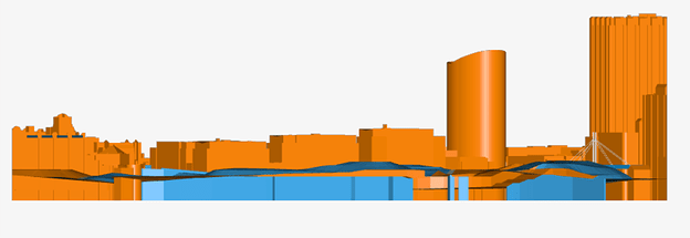
Initially, this is how the model looks with terrain:
We can see here that the bottom of the buildings had been extended to a further distance down the terrain. This is to ensure that there are no gaps between the buildings and the terrain. (we wouldn’t want to have the buildings hovering in space).
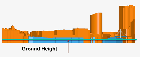
However, it can be understood that this extension down the terrain is artificial and does not really correspond to the actual bottom level of the buildings. This should be taken in consideration when defining the flat ground level of the model.
The actual true ground level of the buildings after the terrain simplification is highlighted in the figure below:
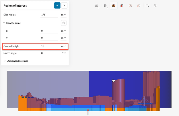
You can incorporate this information into your simulation setup inside the “Region of interest” definition. By adjusting the “Ground height” parameter you can change the bottom level of the virtual wind tunnel and hence define the appropriate ground level for your simulation.


