Here at SimScale, we have a plethora of resources and simulation projects to help engineers and architects alike design buildings that generate minimum undesirable wind effects. This, in turn, works to ensure a safe environment as well as aids pedestrian comfort at a passerby or ground level.
This article illustrates how useful and accessible SimScale’s wind comfort analysis capabilities can be in order to tackle such challenges. This type of simulation has been developed to truly take advantage of the cloud-based computing power and offer accurate, transient and large scale results in a turnover time that is unprecedented in the industry.
Our Case: Stockholm Royal Seaport
In order to put our powerful platform to the test, we are going to look at the example of the Stockholm Royal Seaport urban development project. This recent expansion project that started in the early 2000s is set to create 12,000 new homes and 35,000 workplaces by 2030.
This smart grid development area in the capital of Sweden is a perfect candidate for a wind engineering simulation analysis, ensuring a sustainable, comfortable, and safe environment for the residents of the planned area.

This project is located over a large and exposed area of a semi-coastal environment, which makes wind analysis even more relevant due to strong winds coming off of the sea. Numerical simulation would greatly help architects, urban development managers, and structural engineers to not only spare time invested in designing layouts, elevations, and buildings but also in saving consequent financial investment in multiple resource-intensive wind tunnel tests.
For our case, we will be using the online CFD solution in the form of Lattice Boltzmann method (LBM) analysis provided by SimScale through its integration with Pacefish®. This method (LBM) has been largely developed for this type of wind simulation and, as opposed to traditional steady-state CFD analysis, to easily capture any transient effect of wind passing between buildings, under bridges, around skyscrapers, and over large structures. This way, gusting, channeling, and cornering effects can be fully observed and assessed, as shown in this article.
The Seaport Simulation Setup

Step 1: CAD Creation and Import
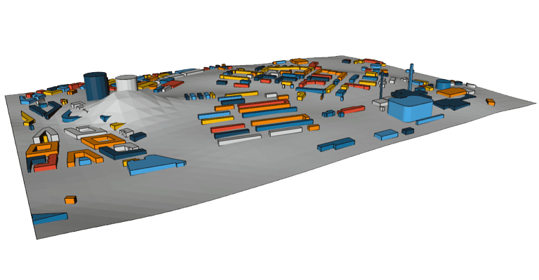
This simulation starts with a CAD model representing the Stockholm Royal Seaport development project topography and buildings. This type of simulation does not require watertight, or seamless geometries in order for the simulation to be performed.
Step 2: Simulation Type Selection

Step 3: Select Zones of Interest
The zone of interest is then visualized in the form of a circular zone, while changes to its location and radius can be made.

In the “wind condition” section, the wind rose data is imported to input the correct wind inlet profile for each direction for the analysis.
The next step consists of defining the zones you would like to obtain output results from. One can select a pedestrian zone at a certain height (1.5m) above the terrain, depending on local conditions and the height you want to obtain results from; foot-level, bench height for people sitting, or head height, for example.

The remaining simulation settings such as the precision refinements and the real-time of the simulation are automated according to the setup, and the simulation computes the calculations in all directions (16 directions in this case).
Download our ‘Tips for Architecture, Engineering & Construction (AEC)’ white paper to learn how to optimize your designs!
The Simulation Results
The results of each run were then accessed from a standard web browser, and any output quantities in the form of cutting planes, streamlines, isosurfaces, etc. were visualized in both a transient and average state.
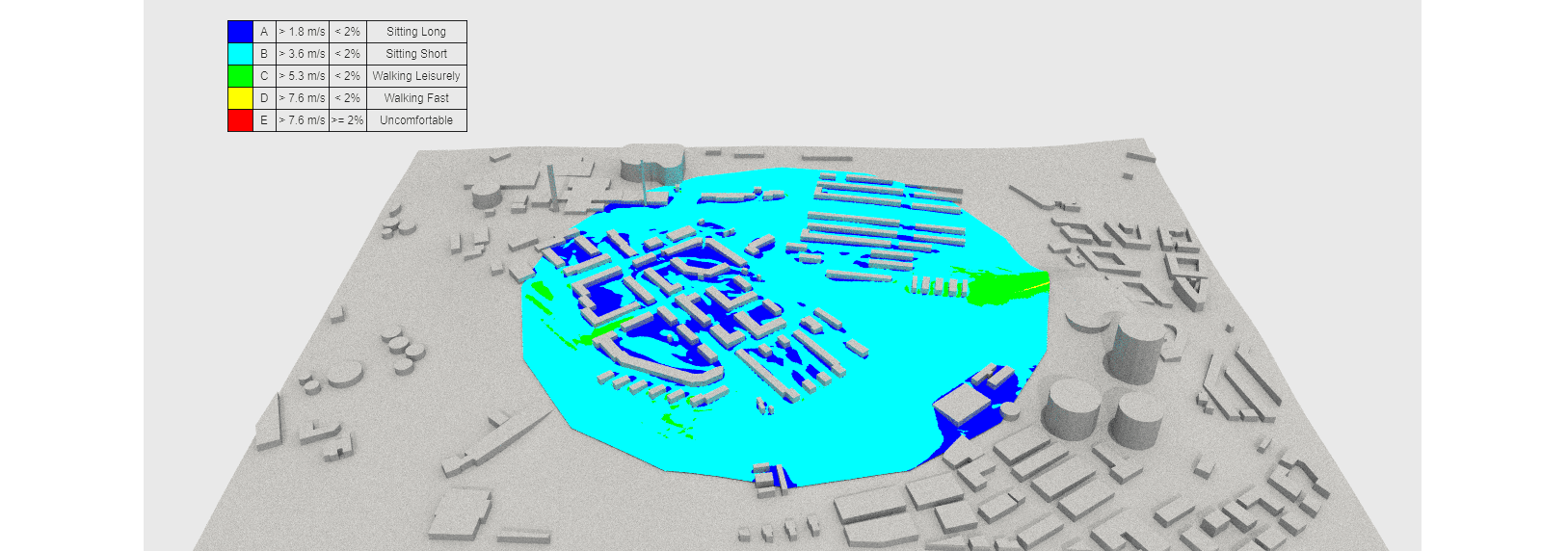
The SimScale online post-processor integrates most of the wind comfort criteria in the industry such as:
- Lawson
- Davenport
- NEN 8100
These criteria essentially combine the calculation results from all of the wind directions and analyze the frequencies of the wind at certain thresholds of velocities. This takes into consideration the frequency at which each point the wind reaches velocities above 5m/s, and this, for all wind directions combined.

This powerful visualization and numerical assessment tool aims to give architects, urban development engineers, and all the stakeholders of projects like the Stockholm Royal Seaport plan insights and meaningful information in order for them to make the best design decisions to produce a sustainable, safe, and comfortable environment for all the residents and pedestrians.


